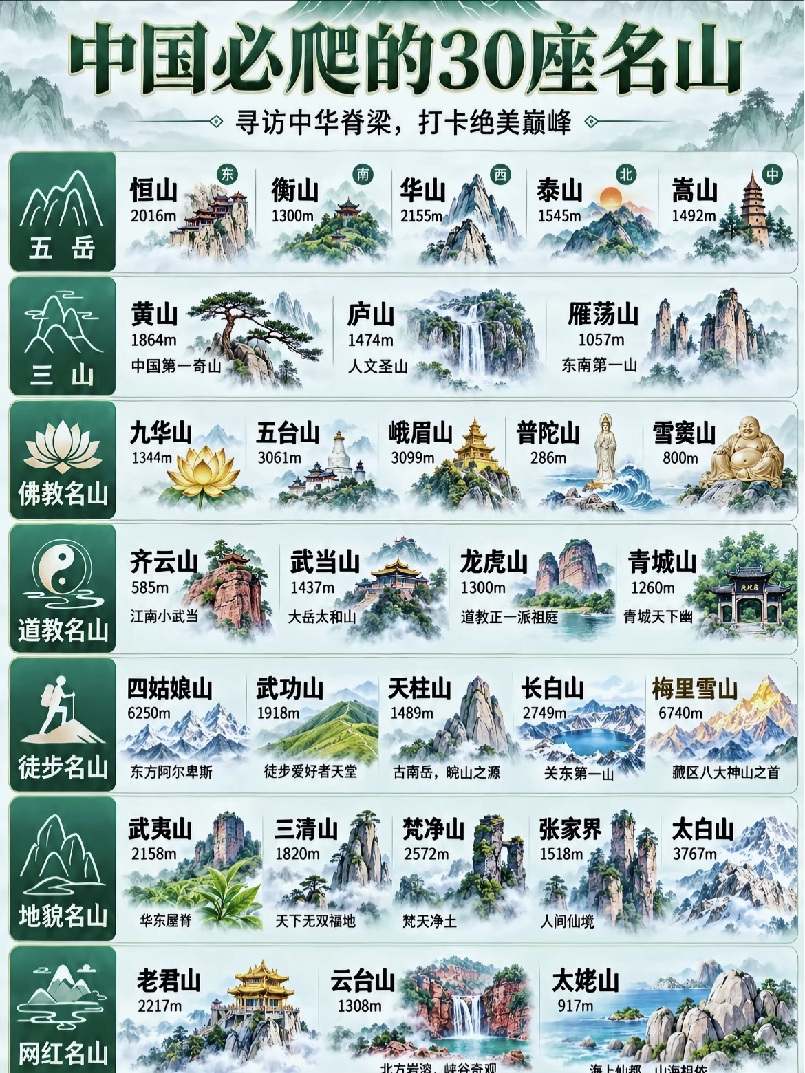
Mountain Infographic Poster
Create Chinese-style mountain posters
Mountain Infographic Poster
Create Chinese-style mountain posters
Showcase
Description
Generate Chinese-style infographic posters of must-visit mountains in China. It creates text-free Chinese watercolor illustration cards for each mountain and assembles them into a complete poster with real Chinese text including mountain names, elevations, and slogans using an HTML template. Use this when users upload mountain or travel guide infographics to recreate, request mountain illustrations, or want to make a must-visit attraction series poster.
Recommended by
Dancang
Why we love this skill
Featured because it solves the problem of distorted Chinese text in image generation by combining text-free illustration generation with HTML real-text layout. It unifies the Chinese-style visuals, mountain data, and grouping structure to reliably replicate exportable mountain infographic posters.
Related Skills
View all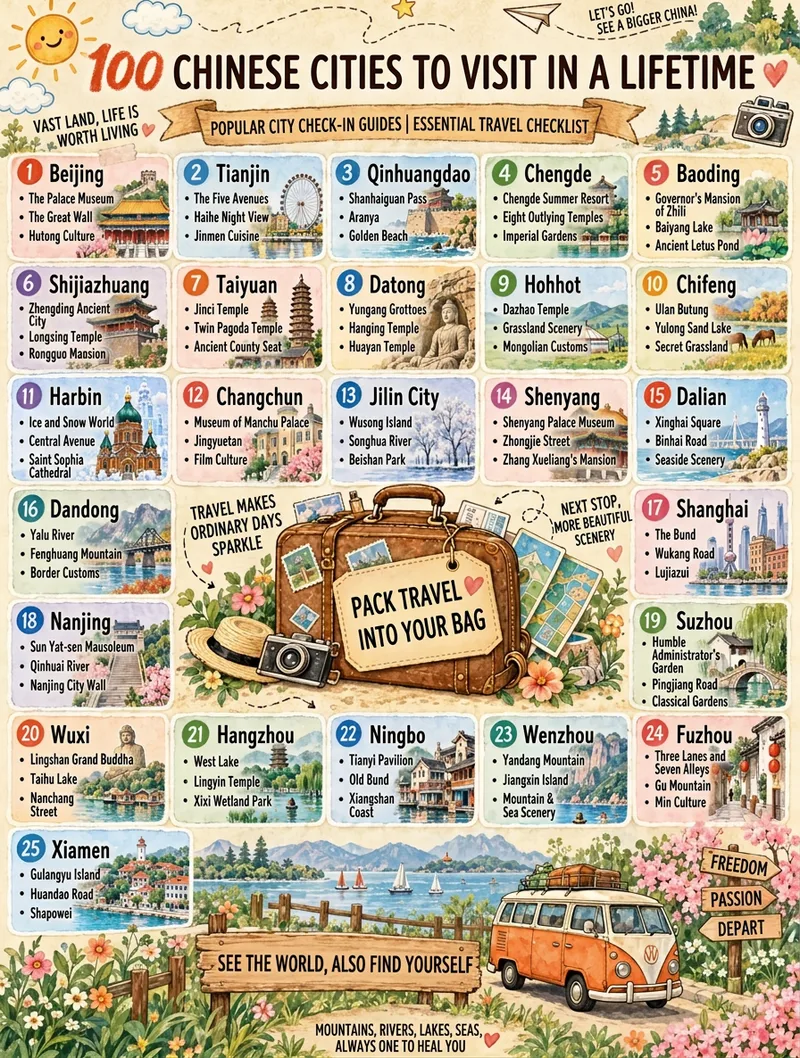 Image
Travel Checklist Poster
Turn any theme (like "25 Chinese Travel Destinations") into a vertical hand-drawn watercolor checklist poster. It features a warm beige textured paper background, travel journal collage style, marker art typography, numbered item cards, a vintage suitcase main illustration, and a scenic landscape band. You can fine-tune the item count, title, subtitle, footer, domain, and aspect ratio. It applies a base template by default and generates the image in one pass using the best image generation model with no watermark.
 Image
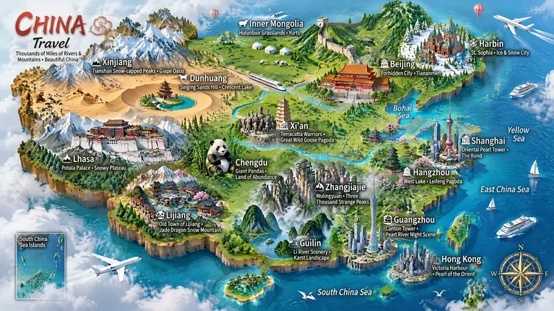
Miniature Maps for Any Place
Best for: travel bloggers, tourism promotion, geography and culture education, hometown promotion, travel guide covers, and social media series. Turn any place into a miniature diorama you can hold in your hands. Just enter a place name. The Skill first identifies whether it is a country, province, city, or town, then researches the area's most representative real landmarks, cultural symbols, and local specialties. Finally, it generates a bright, finely detailed 3D isometric miniature travel map poster. ✅ Landmark research: verify first, then illustrate—no invented buildings, attractions, or place names ✅ All location levels: country / province / city / district or county / town / scenic area ✅ Clear information: place name + icons + keyword labels make each area's character easy to understand at a glance ✅ Default 3:4 portrait format, suitable for Xiaohongshu, Douyin covers, and Pinterest ✅ Flexible styles: 3D miniature, clay, pixel art, watercolor, paper cut, or low-poly ✅ Series-ready: maintain a consistent style for batches such as "All Provinces of China," "Northeast China’s Three Provinces," or "Cities Across China" ✅ Supports Chinese, English, and bilingual Chinese-English labels
 Image
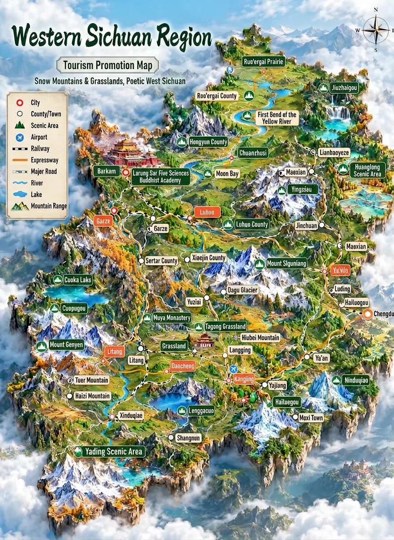
Tourism 3D Map Illustration
Transform a region name (such as "Ganzi" or "Western Sichuan Loop") into a vertical tourism promotion 3D map illustration: a miniature terrain island floating above a sea of clouds, featuring snow mountains, meadows, lakes, canyons, rivers, and roads. It includes a top-left legend, a top-right vintage compass, 15 to 30 colored leader-line labels (prefectural cities, counties/townships, scenic spots, and airports) arranged by real relative positions with miniature landmark icons, large calligraphic region name and ribbon slogan at the top, and an artistic representation notice at the bottom. The region name, eight-character slogan, label list, terrain framework, color scheme, and aspect ratio can all be fine-tuned. It applies a baseline template by default and generates the image in one go using the best image generation model (GPT Image 2) without watermarks.
Information
- Version
- v3
- Last updated
- Runtime credits
- Usage-based
- Models
- Auto