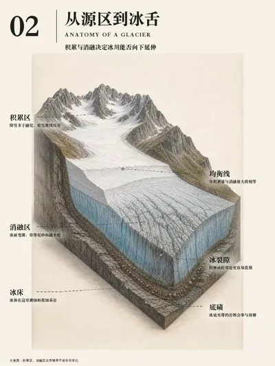
图解地理景观(适合PPT版)
为地理概念生成八张PPT图解
图解地理景观(适合PPT版)
为地理概念生成八张PPT图解
展示內容
描述
Create complete 8-card “万物图解” geography series: warm-paper low-saturation 3:4 portrait explainers with coherent landscape models, cutaways, process stages, selective material or energy flows, precise visible-target labels, micro-detail insets, comparisons, and deterministic Chinese typography. Use when the user gives any landform, geology, climate, atmosphere, hydrology, ocean, ecosystem, settlement, resource, hazard, or other geography concept and asks for 万物图解、八张图解、地理概念拆解图、立体剖切图、景观分解图、机制示意图、公众号/小红书科普图,or asks to match the visual language of “万物图解局”.
相關技能
查看全部图解地理万物
输入一个地理概念名称,生成一套8张竖版3:4图解卡片,将复杂地理知识拆解为连贯的视觉叙事,适用于高中地理教学与科普传播。

给文章配图大师
Generate Guizang-style material illustrations, labeled explanatory visuals, material-styled chart illustrations, and data-first editorial images from articles, notes, product concepts, workplace reports, creator posts, tutorials, school materials, humanities topics, science explanations, screenshots, or chart data. Use when the user asks for 配图, 带字插图, 解释图, 图解插画, 概念拆解图, 图表美化, 数据图美化, 3D 图表, 汇报配图, 内容配图, 小学课文配图, 生物/化学/物理解释图, 人文类配图, process/loop/system diagrams, or wants GPT-Image / image generation to create supporting images that can sit inside social cards, docs, slides, PPTs, or posts.
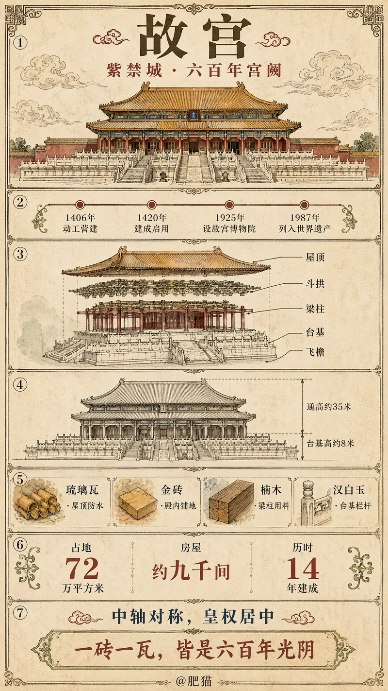 圖片
(爆火)万物信息图
输入一个主题词,自动判类别、联网核实关键事实并生成文案,默认输出一张「通用深度版」竖版超长图(9:16):按固定 7 段把「时间·结构·图解·图例·数据·人文」一次讲透,图解内容随类别自适应(建筑=工程图纸、动物=解剖与分布、人物=关系与成就图谱…)。需要轻量时也可切「标准科普版」(3:4)。两版风格、字体、配色、边框完全统一,可直接发布抖音/小红书起号。