One-Line Travel Poster
One place, one line, a save-worthy poster
One-Line Travel Poster
One place, one line, a save-worthy poster
Showcase
Description
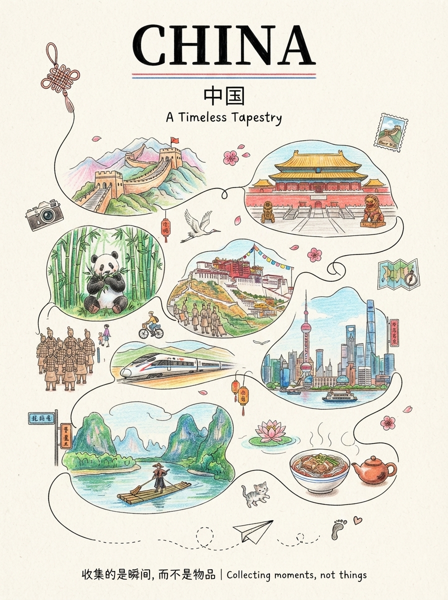
Anything can be illustrated: countries, provinces, cities, counties, towns, and villages are all supported. The system automatically identifies the geographic level—choosing landmarks for larger places and capturing the character of everyday life in smaller ones. ✏️ Authentic hand-drawn feel: colored pencils and crayons, with visible paper texture, pencil strokes, and naturally unsteady linework 🔍 Details worth discovering: hidden cats, birds, postcards, tickets, and other small surprises that reveal themselves when you zoom in 🔤 Bilingual title: English + Simplified Chinese by default, with customizable languages 📐 Default 3:4 portrait format: ready for Xiaohongshu and Douyin covers, phone wallpapers, and printed decorative art 🎨 Magazine-style layout: an ivory-beige paper background with a handwritten tagline, suitable for sharing on social media, tourism promotion, and travel check-ins Who it's for: Travel bloggers, tourism promotion, social media covers, hometown promotion, birthday or anniversary gifts, and decorative art design.
Recommended by
淡苍
Why we love this skill
Turns a place name into a collectible travel story with landmarks, local flavor, hidden details, and a distinctive hand-drawn poster style.
Best for
Travel bloggers, tourism promotion, social media covers, and creating hometown or anniversary-themed decorative posters.
How to use this Skill
Provide your input
Enter a country, region, city, county, town, or village. You can also specify the title language and image aspect ratio.
Run the Skill
The system creates a travel illustration poster based on the location, connecting local scenery, daily life, and cultural elements with a continuous hand-drawn line, plus a restrained bilingual title and tagline.
Review your result
Get a portrait travel illustration poster with colored-pencil and crayon textures, paper grain, and rich travel details—ready to share, promote, or display.
Related Skills
View all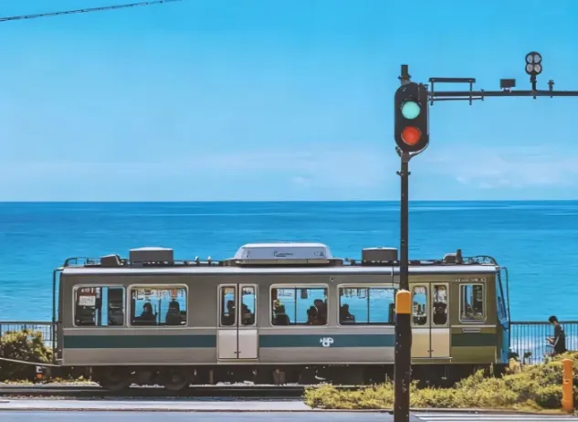 Image
ImageJapanese Watercolor from Photos
Turn landscape and streetscape photos into Japanese gallery-style, hand-painted watercolor art illustrations, complete with generous paper space and refined handwritten typography. ✨ Key highlights Gallery-quality negative space: The subject is kept small and centered, surrounded by generous warm-white cotton paper texture for a modern stationery and art-print feel. Authentic hand-painted watercolor texture: Naturally creates washed, blended effects, translucent layers of color, and loose hand-painted edges—without harsh outlines or a digital look. Intelligent scene refinement: Preserves key landmarks, architectural outlines, and distinctive light and shadow from the original image while naturally simplifying busy backgrounds and unnecessary objects. Poetic handwritten typography: Automatically adds a poetic short line and year at the bottom in dark gray or navy handwritten lettering, creating a calm, restrained everyday atmosphere. 📸 Ideal uses Reimagining travel memories: Turn streets, small shops, mountains, and seascapes from your travels into vintage postcards. Personal creative designs: Create phone wallpapers, stationery posters, physical postcards, and decorative art prints. Social media visuals: Provide restrained, sophisticated, and stylistically consistent artistic covers for platforms such as Xiaohongshu and WeChat Moments. 🚀 How to use Upload any landscape, architecture, or streetscape photo with a clear composition to automatically generate a matching minimalist watercolor art print.
 Image
Image3D Aerial Route Map
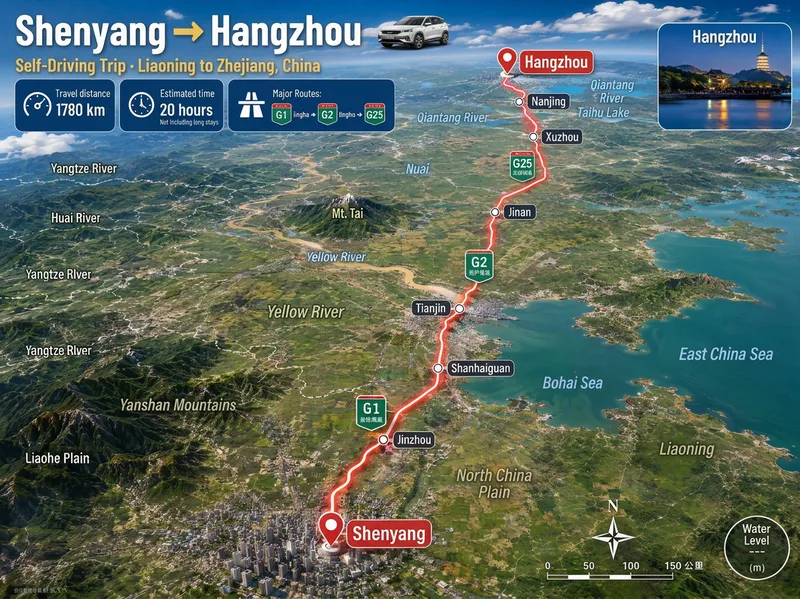
Ideal for: 1. Travel, road-trip, and local discovery content creators. 2. Guide creators on Xiaohongshu, Douyin, and WeChat Official Accounts. 3. Operators at travel agencies, guesthouses, car rental companies, and tourism bureaus. 4. Video editors who need "route animation assets" for short-video openings and transitions. 5. Teachers, geography enthusiasts, and people creating educational travel materials. 6. Anyone who wants to make a commemorative "Our Route" poster for a partner or friends. Enter a city, town, village, or country. Mountains, deserts, river valleys, and coastlines are recreated from real maps, with distance, travel time, road numbers, and stops provided at once. The image includes a prominent headline, three information cards for distance, travel time, and the main route, a glowing red route line, labels for real stops, road-number shields, province or country borders, names of mountains, deserts, forests, and other terrain along the route, a small destination landmark image, a compass, and a scale bar. The default format is 3:4 portrait with Simplified Chinese. Both the aspect ratio and language can be customized. Routes across seas or continents automatically switch to flight paths or dashed ferry routes.
 Image
ImageCity Architecture Passport
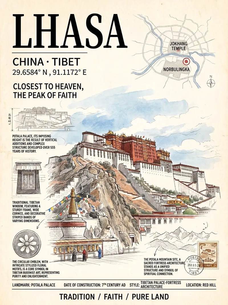
Ideal for travel posts, creative merchandise, social media covers, and home decor. Just enter a city name to automatically select its most representative landmark and generate a vertical travel poster in an “architecture passport” style: the main building is delicately rendered in colored pencil and watercolor, surrounded by a subtle city map, architectural survey drawings, detail close-ups, latitude and longitude, and handwritten annotations. It features an ivory paper texture and an upscale magazine-cover layout. All text in the image is in Simplified Chinese. The default aspect ratio is 3:4, and a custom ratio can be specified.
Information
- Version
- v4
- Last updated
- Runtime credits
- Usage-based
- Models
- Auto
- Use cases
- Images & designMarketing & growthLifestyle & entertainment
- What you get
- Image
- Visual styles
- EditorialHand-drawnPaper art