City Landmark Diorama
Grounded sites, bold landmarks, airy color
City Landmark Diorama
Grounded sites, bold landmarks, airy color
Description
Turn a city’s representative landmarks into a miniature map illustration that combines geographic grounding with visual appeal. Simply provide the city name along with any preferences for coverage, language, scale, or style. The Skill will organize the relative positions of around 5–8 key landmarks, riverbank relationships, roads, bridges, and distances between landmarks, while shaping the scene around local architectural character. The final result is a complete, ready-to-view city landmark diorama—not just a prompt or composition plan. The scene uses a full-frame warm-toned map surface, refined, colorful 3D diorama models, a small and varied selection of background buildings, and clear Chinese labels to emphasize the visual hierarchy of “large landmarks, small buildings.” It also retains a city title plaque in the upper left, a north arrow in the upper right, and necessary artistic annotations. This makes it suitable for city introductions, travel and cultural content, regional overviews, and visual presentations. After generation, it also checks landmark recognizability, relative positions, river and road relationships, label text, and compositional consistency, making corrections when needed. This is an artistic illustration of city locations and does not replace navigation, surveying, or a map with a precise scale. When web research and image-generation capabilities are available, it can include brief sources, the research date, and reusable prompts. If image generation is not currently available, it provides a complete image-generation prompt and a location list.
Recommended by
淡苍
Why we love this skill
It combines accurate relative locations with boldly exaggerated 3D landmarks in a cohesive warm-toned map layout, producing miniature city illustrations that are both visually appealing and geographically grounded.
Showcase
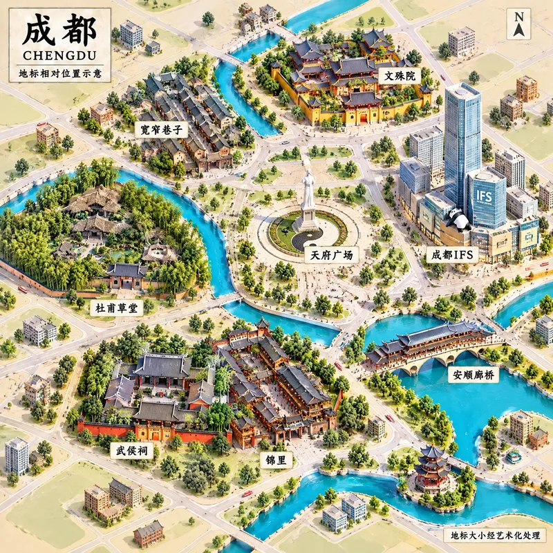
成都地标微缩景观
成都|城市地标微缩示意图
Related Skills
View all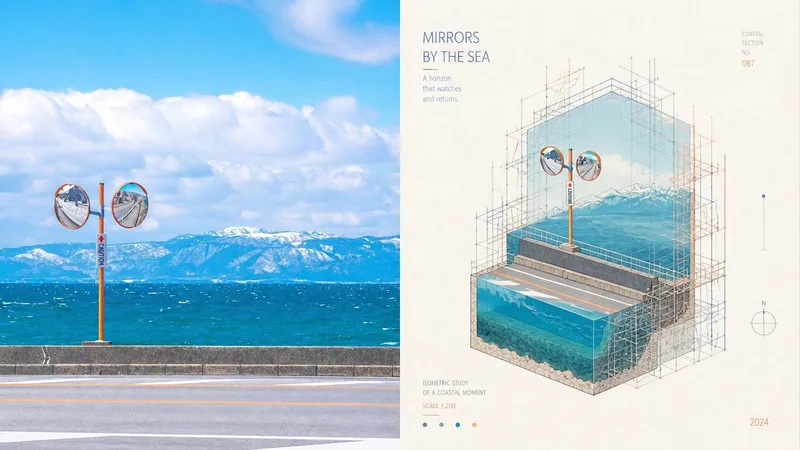 Image
ImageXiaodong x Miniature P073
Ordinary miniature scenes can end up looking like nothing more than cute models; scaffolding is also often treated as decorative lines with no structural role, making the spatial relationships unable to withstand close inspection. Panel 073 compresses the subject into a cutaway isometric miniature architectural landscape, presented through underwater-continental-shelf-like sections and layered space. The detailed scaffolding is not mere decoration: it genuinely wraps around, supports, frames, or intervenes in the subject along its contours, turns, and cutaway sections, making the image feel like an architectural study in progress—being constructed, repaired, surveyed, or displayed. White textured paper, vivid and transparent colors from the source image, and restrained editorial annotations give the finished work both the precision of an architectural diagram and the lightness of an art poster. Suitable for these situations Need accurate isometric and cutaway space: Views, layers, and sectional relationships remain clear without using incorrect perspective to create a false sense of depth. Want scaffolding with real logic: Horizontal and vertical components, along with connecting nodes, serve to wrap, support, repair, or survey the structure. Like architectural research posters: Miniature models, fine-line diagrams, white textured paper, and restrained annotations create the order of an exhibition catalog. Need flexible delivery: Supports top-and-bottom, left-and-right, standalone designs, multiple aspect ratios, and four-edge wallpapers, and can also process image directories in batches.
 Image
ImageCity Observer Poster
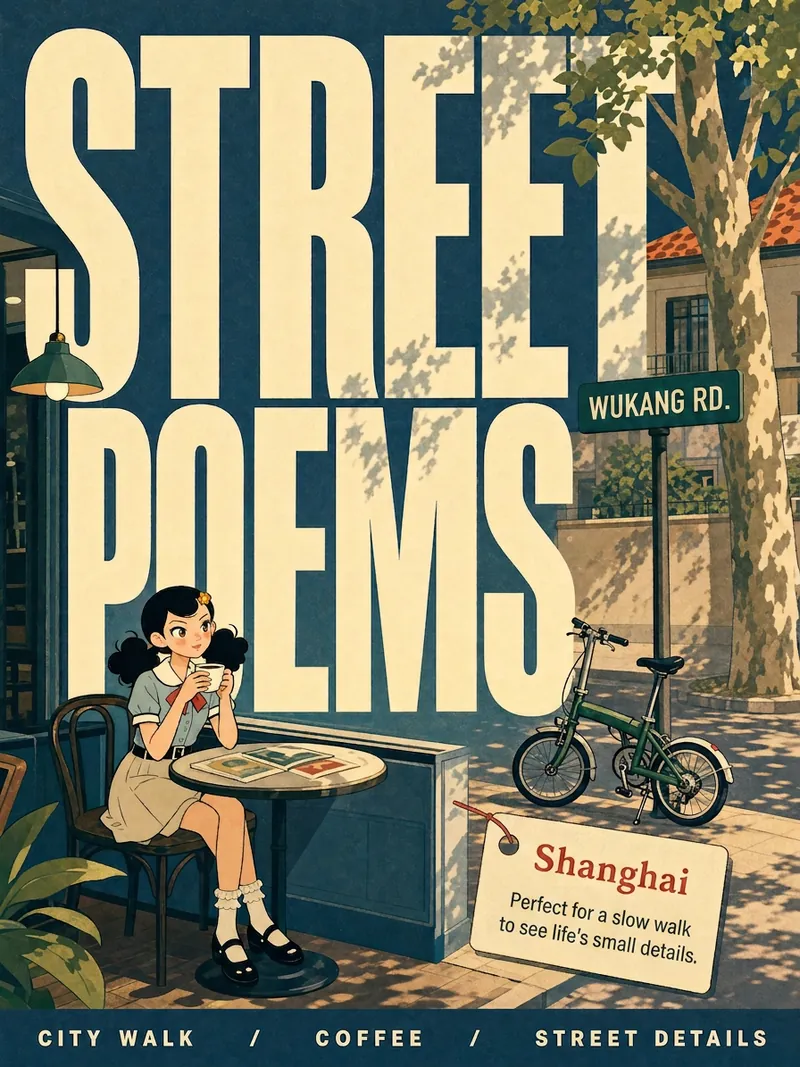
Upload any character image and name a city to create a collectible City Observer poster. This is not a tourism promo—it’s a visual note on the city’s mood. The Skill preserves the character’s recognizable features, translates them into a unified flat illustration style, and places them in everyday city scenes. The three-step process (character analysis → city concept card → image generation) lets you confirm each step. A consistent visual system: vertical 3:4 format, oversized English title, blue-cyan line art, risograph print texture, and limited-color editorial layout. Create 10 cities and you’ll have a cohesive 10-poster city atlas. Minimum input: one image + a city name.
 Image
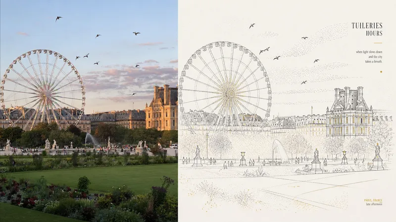
ImageXiaoxiaodong x Line/Dot x P084
Panel 084 uses fine black or dark lines to distill the main subject, buildings, roads, and spatial relationships. Vertical, horizontal, angular, and curved lines, along with perspective guide lines, establish the geometric framework. Stippling/dotted texture then uses variations in density to shape the sky, ground, distant views, tree shadows, lighting, and the atmospheric layers around the subject. Complex backgrounds are deliberately reduced, leaving a clear focal point, generous negative space, and a few accent colors with identifiable sources. Best suited for these situations When cities, buildings, and spatial relationships need to remain clear: Use geometric fine lines, perspective guide lines, and key contours to distill roads, buildings, and scene structure. When you want to express air, light, and depth without filling the image with texture: Create quiet layers through gradual changes in stippling/dotted texture density. When you prefer a restrained color palette: Use blue-gray, off-white, and warm white as the main colors, with only a few spot colors from the original image illuminating the focal points. When you need flexible delivery: Supports top-and-bottom, left-and-right, pure-design, multi-ratio, and four-edge wallpapers, and can also process image directories in batches.