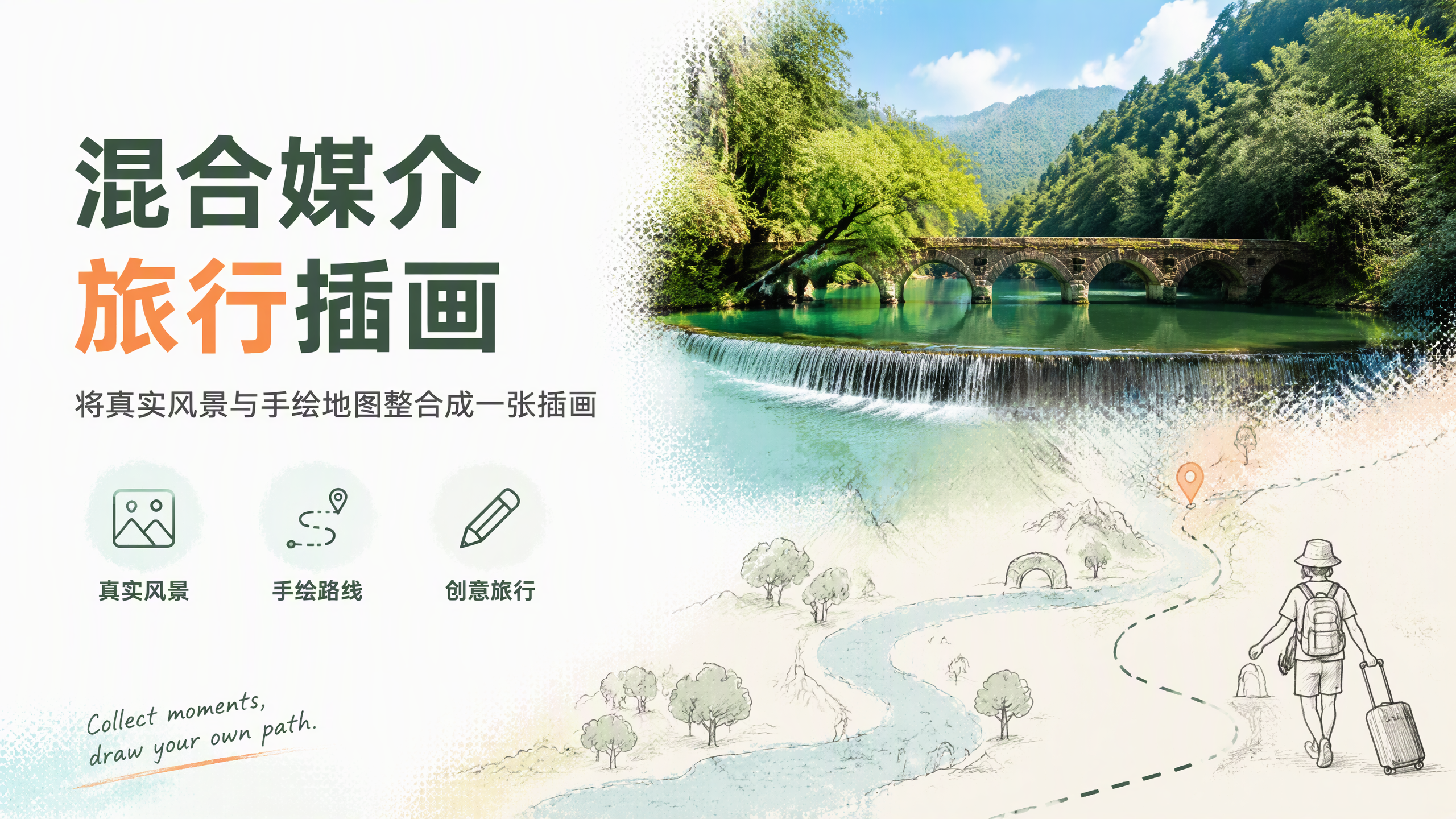
Mixed-Media Travel Illustration
Real photo top, hand-drawn map bottom
Mixed-Media Travel Illustration
Real photo top, hand-drawn map bottom
Showcase
Description
Turn any travel destination into a vertical mixed-media illustration featuring a photorealistic landscape in the upper half and a beige paper-textured hand-drawn map in the lower half. Natural textures blend into a route band led by a pencil-sketched tiny figure, finished with a handwritten English quote in the corner. Defaulting to Libo Xiaoqikong in Guizhou as the baseline template with a 3:4 vertical ratio. Locations, textures, route shapes, decorative symbols, quotes, and aspect ratios are fully customizable, generated directly using the best image model available.
Recommended by
Dancang
Why we love this skill
Cleverly blends photorealistic landscapes with off-white hand-drawn maps, creating a unique narrative through continuous textures, irregular borders, and a traveling figure at the end of the route.
Related Skills
View all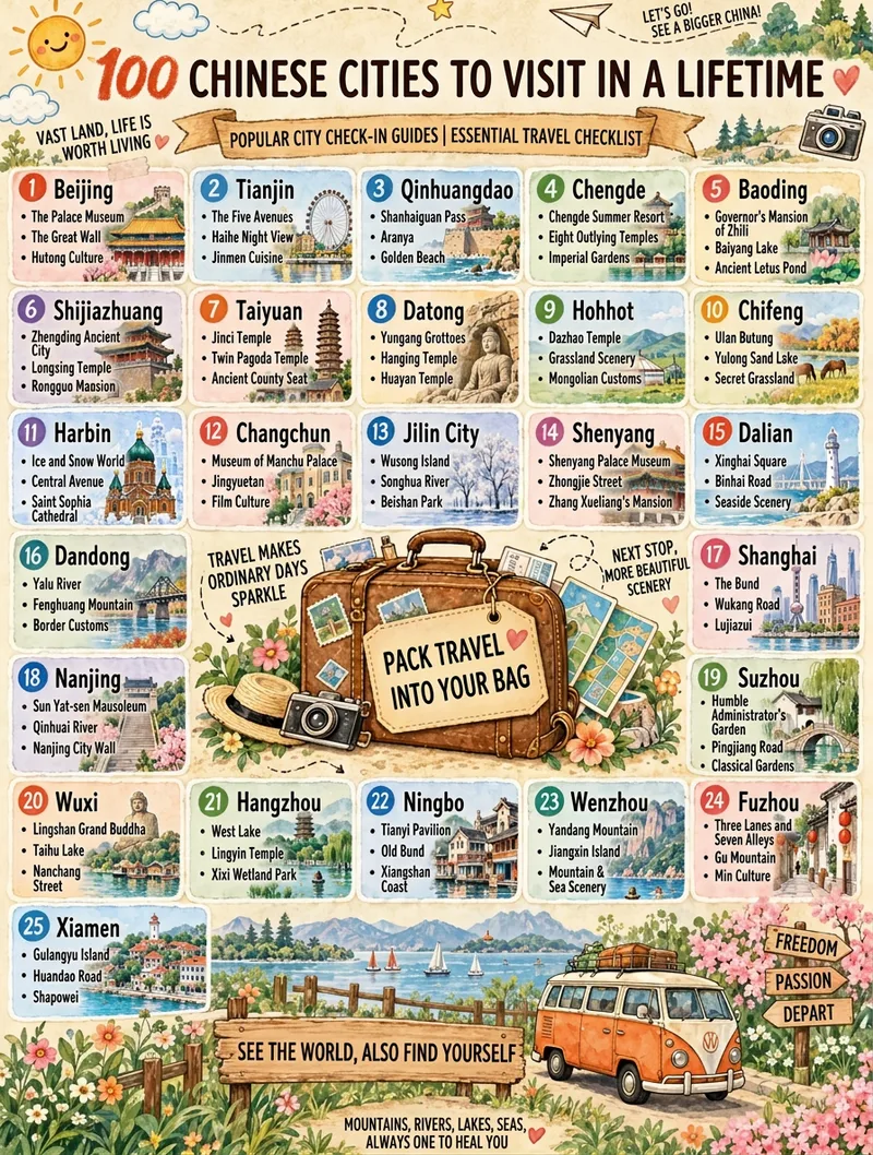 Image
Travel Checklist Poster
Turn any theme (like "25 Chinese Travel Destinations") into a vertical hand-drawn watercolor checklist poster. It features a warm beige textured paper background, travel journal collage style, marker art typography, numbered item cards, a vintage suitcase main illustration, and a scenic landscape band. You can fine-tune the item count, title, subtitle, footer, domain, and aspect ratio. It applies a base template by default and generates the image in one pass using the best image generation model with no watermark.
 Image
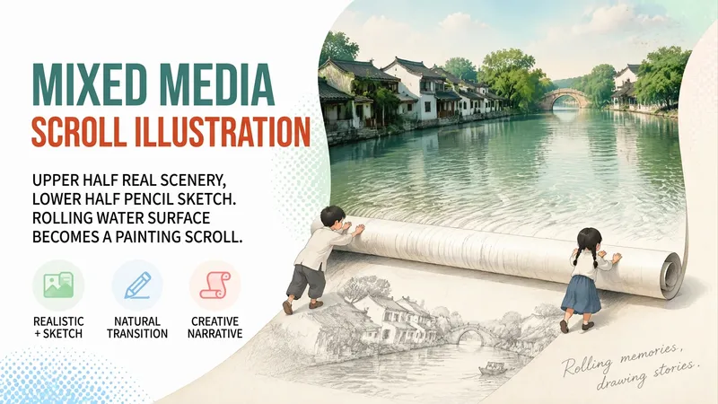
Mixed-Media Scroll Illustration
Transform any landscape into a vertical mixed-media illustration featuring realistic photography on the top half and a pencil sketch on the bottom half. The water in the photo is rolled up into a physical scroll by two hand-drawn children, with water ripples continuing onto the scroll's surface. At the junction, the ripples smoothly transition into pencil strokes and fade into the paper white, accompanied by a handwritten English phrase in the bottom right corner. It defaults to a Jiangnan water town scene, but you can also directly specify scenes like snow-capped mountains and lakes or coastal highways, generating images directly using the top image generation model.
 Image
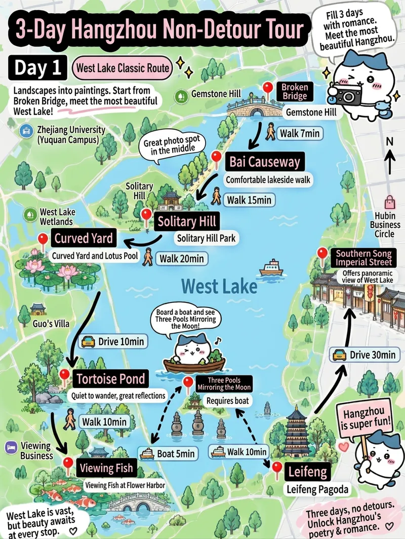
Hand-Drawn Travel Route Map
Transform a city itinerary (city, days, route name, one-sentence theme, 5–8 stops with relative positions and reviews) into a vertical hand-drawn travel route map illustration. Features a fixed layout with a top title area, hand-drawn overhead map, red pin stops connected by direction, black arrows and white capsule transit labels, a mascot cat speech bubble, and disclaimer text in the bottom left. Defaults to a 3:4 vertical aspect ratio, 1 image, and a cute, fresh hand-drawn watercolor style, with adjustable color schemes, art styles, mascots, and aspect ratios. Automatically uses the current best image generation model for direct output without repeated redrawing.
Information
- Version
- v3
- Last updated
- Runtime credits
- Usage-based
- Models
- Auto